Skip to content
SIWOMSPACE

SIWOM Space / Planetary exploration technology

Building Intelligence for Worlds Beyond Earth.

We develop planetary intelligence software and autonomous exploration technologies to help understand extraterrestrial terrain, plan robotic missions, and advance humanity's ability to explore the Moon and Mars.

The globe rotates slowly. Markers show Jezero and Gale craters, where NASA's Perseverance and Curiosity rovers operate, and other named features.

01SIWOM Space

Software that turns planetary data into decisions about terrain.

SIWOM Space builds the intelligence layer for exploring other worlds: software that reads orbital imagery and elevation models, works out what the terrain means for a robot or an explorer, and plans how to cross it.

What we build

Planetary mapping, terrain-analysis and route-planning software — running in the browser today, built on documented NASA and USGS data.

Who it is for

Researchers, students and engineers studying planetary surfaces; teams developing mission concepts; organisations working in geospatial and planetary intelligence.

How it works

Scientific data is validated, turned into terrain models, analysed for slope and hazards, and used to plan routes you can inspect, compare and export.

Every capability carries its real status.

See all projects
Available
Usable today on this website, with the data and limits stated alongside it.
Prototype
Working software with known limitations. Not validated for operational use.
Research
Being investigated. Early methods may appear inside a prototype; no dedicated release yet.
Planned
On the roadmap. Design or scoping only; no working software yet.
02The challenge

Every mission starts with a question about the ground.

Where can we land? Where can we drive? What will we find there, and what could stop us? Answering these on another world is hard for reasons that have little to do with rockets.

The Moon

Our first destination: low gravity, airless, with extreme lighting near the poles.

Mean radius
1,737.4 km
Surface gravity
1.62 m/s²
One-way signal delay
≈ 1.3 s
Finest orbital imagery
≈ 0.5 m/px (LROC NAC)

Source: NASA Moon Fact Sheet (opens in a new tab) · drag or use arrow keys to rotate

Mars

Far enough that robots must decide alone between commands from Earth.

Mean radius
3,389.5 km
Surface gravity
3.71 m/s²
One-way signal delay
≈ 3–22 min
Finest orbital imagery
≈ 0.25 m/px (HiRISE)

Source: NASA Mars Fact Sheet (opens in a new tab) · drag or use arrow keys to rotate

  1. 01

    The ground is known only from orbit

    Before a rover arrives, every map comes from orbiters. Their resolution sets what can be seen: boulders, ripples and small scarps hide below the pixels of most elevation models.

  2. 02

    Robots must decide on their own

    Signals take about 3 to 22 minutes to reach Mars, one way. A rover cannot be driven in real time; it needs good plans and the autonomy to follow them safely.

  3. 03

    Data is scattered and uneven

    Imagery, elevation and mission records live in different archives, formats, map projections and reference surfaces. Using them together demands careful, documented processing.

  4. 04

    Steepness is only part of the risk

    Loose sand, rock fields, darkness near the lunar poles, temperature extremes and communication blackouts all shape a route. A credible planner says what it does not model.

03Our approach

One pipeline, from archive to route.

Every result on this site passes through the same six stages. Select a stage to see what it does, what kind of result it produces, and where it runs today.

Stage 01 / 06

Scientific data

Collect documented planetary imagery, elevation data and mission metadata from supported sources.

MeasuredAvailable
  • Prefer official downloads and supported services: USGS Astrogeology, NASA PDS nodes, NASA Solar System Treks.
  • Record the product, version, DOI, licence and retrieval date with every file.
  • Never scrape restricted systems; cache downloads and respect rate limits.

On this website

USGS Mars 2020 TRN CTX DTM and orthoimage (CC0), Viking MDIM 2.1, MOLA, the Perseverance traverse and IAU names.

04Projects

Working software first. Claims second.

Two of our projects run today — one on this website, one as a standalone prototype. The third is planned and labelled that way.
CTX orthoimage of western Jezero Crater used by the Terrain Lab
Available

Mars · interactive, on this website

SIWOM Terrain Lab

A browser laboratory for terrain analysis on real Mars elevation data. Inspect western Jezero Crater in 3D, switch between surface, elevation, slope and hazard layers, and compute routes under a slope limit.

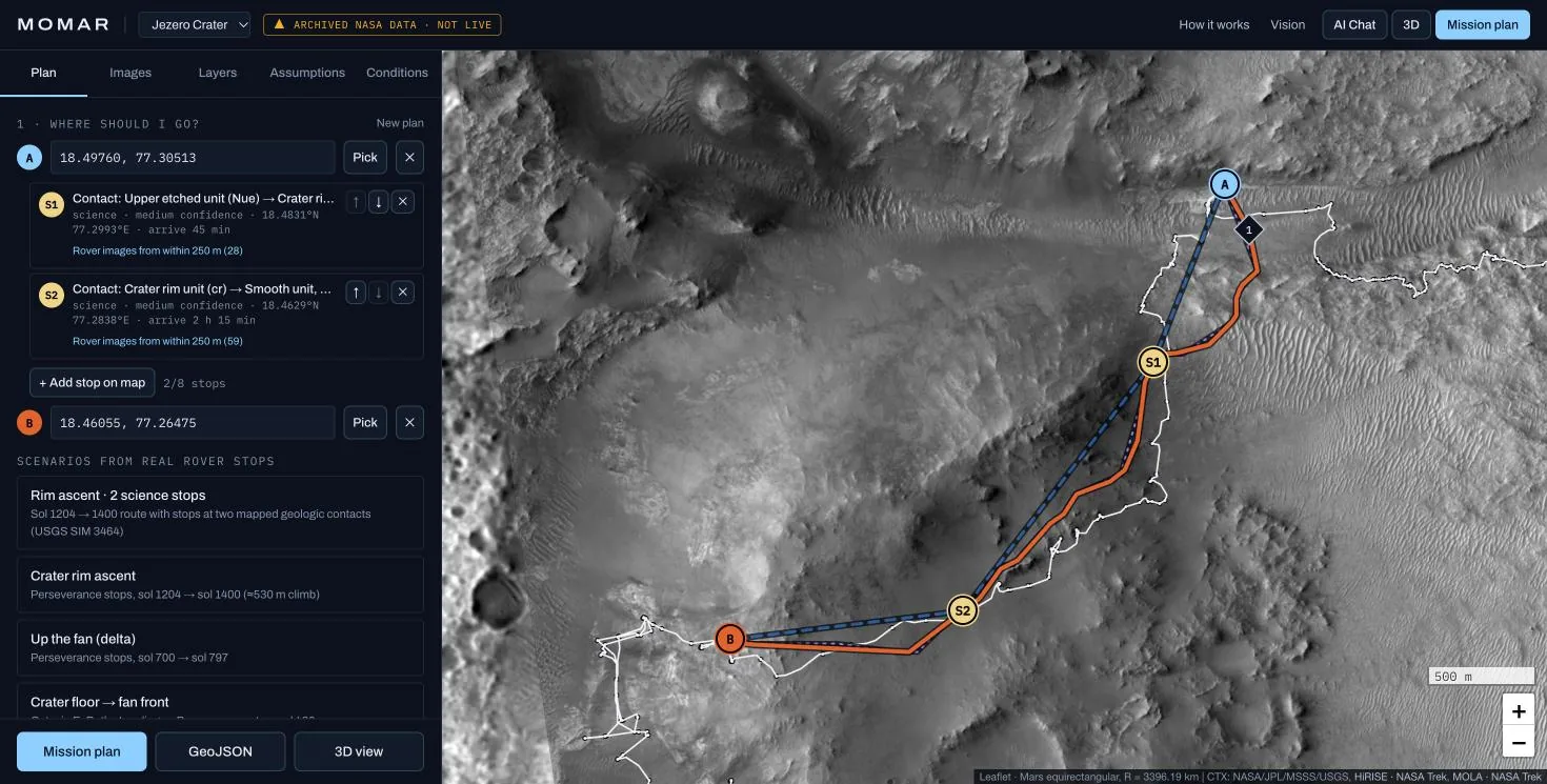
MOMAR planner showing shortest and lower-risk routes up the Jezero crater rim on CTX imagery
Prototype

Mars · standalone prototype

MOMAR — Planetary Terrain Intelligence

A browser-based planner that layers real NASA, ESA and USGS data over Mars so an explorer can ask three questions: where should I go, how do I get there with lower terrain risk, and what science lies on the way?

Planned

Moon · mission context

CLPS Lunar Mission Browser

A planned browser-based platform for exploring lunar mission information, terrain and scientific context relevant to NASA's Commercial Lunar Payload Services (CLPS) deliveries.

05Terrain Lab · live

Plan a route across Jezero Crater.

Real elevation data from NASA's Mars Reconnaissance Orbiter, processed by USGS, analysed in your browser. Pick two points — or load recorded Perseverance stops — and compare a shortest route with a lower-slope one.

Preparing the Terrain Lab…

06Research & engineering roadmap

From terrain understanding to autonomous exploration.

The order matters: reliable data and terrain analysis first, then mission planning, then autonomy — and hardware only when the engineering justifies it. Phases are sequenced, not dated.
  1. Phase 01Now

    Planetary data foundations

    Turn documented orbital data into terrain understanding that anyone can inspect.

    • SIWOM Terrain LabAvailable
    • Dataset catalogue with provenanceAvailable
    • MOMAR Mars plannerPrototype
  2. Phase 02Next

    Lunar and mission context

    Extend the same pipeline to the Moon and to mission-level questions.

    • CLPS Lunar Mission BrowserPlanned
    • LOLA and LROC processing pipelinePlanned
    • Illumination and shadow analysisPlanned
  3. Phase 03Later

    Autonomy research

    Move from planning on maps toward decisions a robot could make on its own.

    • Any-angle, uncertainty-aware planningResearch
    • Rover-scale terrain perceptionPlanned
    • Robotic exploration simulationPlanned
  4. Phase 04Long term

    Robotics and hardware interfaces

    Connect software to robotic platforms — hardware only where engineering progress supports it.

    • Simulation-to-robot software interfacesPlanned
    • Embedded and onboard computing researchPlanned
    • Rover hardware prototypesPlanned
07Open data & scientific foundations

Every pixel has a source.

We build on public planetary archives and say exactly which products we use, how we processed them, and what they cannot tell you. These are integrated on this website today.
Datasets integrated on this website
DatasetInstitutionResolutionLicenceStatus
Mars 2020 Terrain Relative Navigation CTX DTM mosaicMarsUSGS Astrogeology Science Center for NASA/JPL (MRO Context Camera stereo)20 m posts (source); 100 m block means on this site. Metres above the MOLA areoid.CC0 1.0 (USGS data release)Integrated here
Mars 2020 Terrain Relative Navigation CTX orthoimage mosaicMarsUSGS Astrogeology Science Center (MRO Context Camera)6 m/pixel (source); about 19 m/pixel on this siteCC0 1.0 (USGS data release)Integrated here
Perseverance rover traverseMarsNASA/JPL-Caltech Mars 2020 team (MMGIS location feed)Rover localization (metre scale); simplified to a 4 m toleranceNASA public dataIntegrated here
Viking MDIM 2.1 colour mosaic (global)MarsUSGS Astrogeology Science Center (NASA Viking Orbiter data)925 m/pixel (source); 4096 × 2048 (~5.2 km/pixel) and smaller on this sitePublic domain (USGS/NASA)Integrated here
MGS MOLA global DEMMarsUSGS Astrogeology / MOLA Science Team (NASA GSFC)463 m/pixel (source); gradients at ~10 km/pixel on this sitePublic domain (USGS/NASA)Integrated here
Gazetteer of Planetary NomenclatureMarsIAU WGPSN / USGS AstrogeologyPoint featuresPublic domain (USGS)Integrated here
CGI Moon Kit (LRO LROC WAC colour mosaic, LOLA elevation)MoonNASA Scientific Visualization Studio (data: LRO LROC WAC, ASU; LRO LOLA, NASA GSFC)2k colour map and 1k 8-bit elevation map (display products)NASA media: see NASA Images and Media Usage GuidelinesIntegrated here
08Long-term vision

From maps to machines that explore on their own.

Humanity's next steps on the Moon and Mars will be taken first by robots. They will need to understand terrain, weigh risk and choose a path without waiting for Earth. That is the capability we are building toward — one verifiable layer at a time.

Today

Software that turns orbital data into terrain understanding, with every assumption visible.

Next

Planning tools for lunar and Martian mission concepts: regions, routes, lighting and constraints.

Long term

Autonomy software that lets robotic explorers reason about terrain themselves — and the robotic systems, once engineering progress supports them.
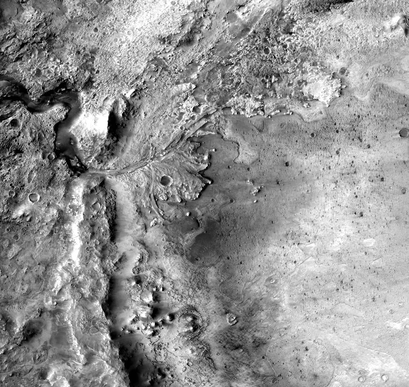

Background · Jezero crater, 100 m contours from the USGS CTX DTM

09Collaborate

Working on planetary data, robotics or mission design?

We welcome conversations with universities, research groups, planetary scientists, robotics engineers and space-technology companies.